Monitoring a Changing River - OART’s Adur Adaptation Partnership
In the face of climate change, restoring a river’s resilience means not just “doing things on the ground” but also measuring carefully how those interventions shift hydrology and ecology over time. The Adur Adaptation Project, led by Ouse & Adur Rivers Trust (OART) in partnership with the Environment Agency and local councils, is doing just that: combining nature-based solutions with strategic monitoring to reduce flood risk, bolster drought resilience, and enhance river-wetland habitat. (Ouse & Adur Rivers Trust)
H2Ogeo has provided monitoring support to the OART Team deploying remote, automated groundwater elevation sensors that track water elevations.
Thanks to funding support under the Green LEAP scheme from Horsham District Council, H2Ogeo has rolled out its new capabilities for real-time water elevation monitoring. (H2Ogeo)
What H2Ogeo deployed, and how it works
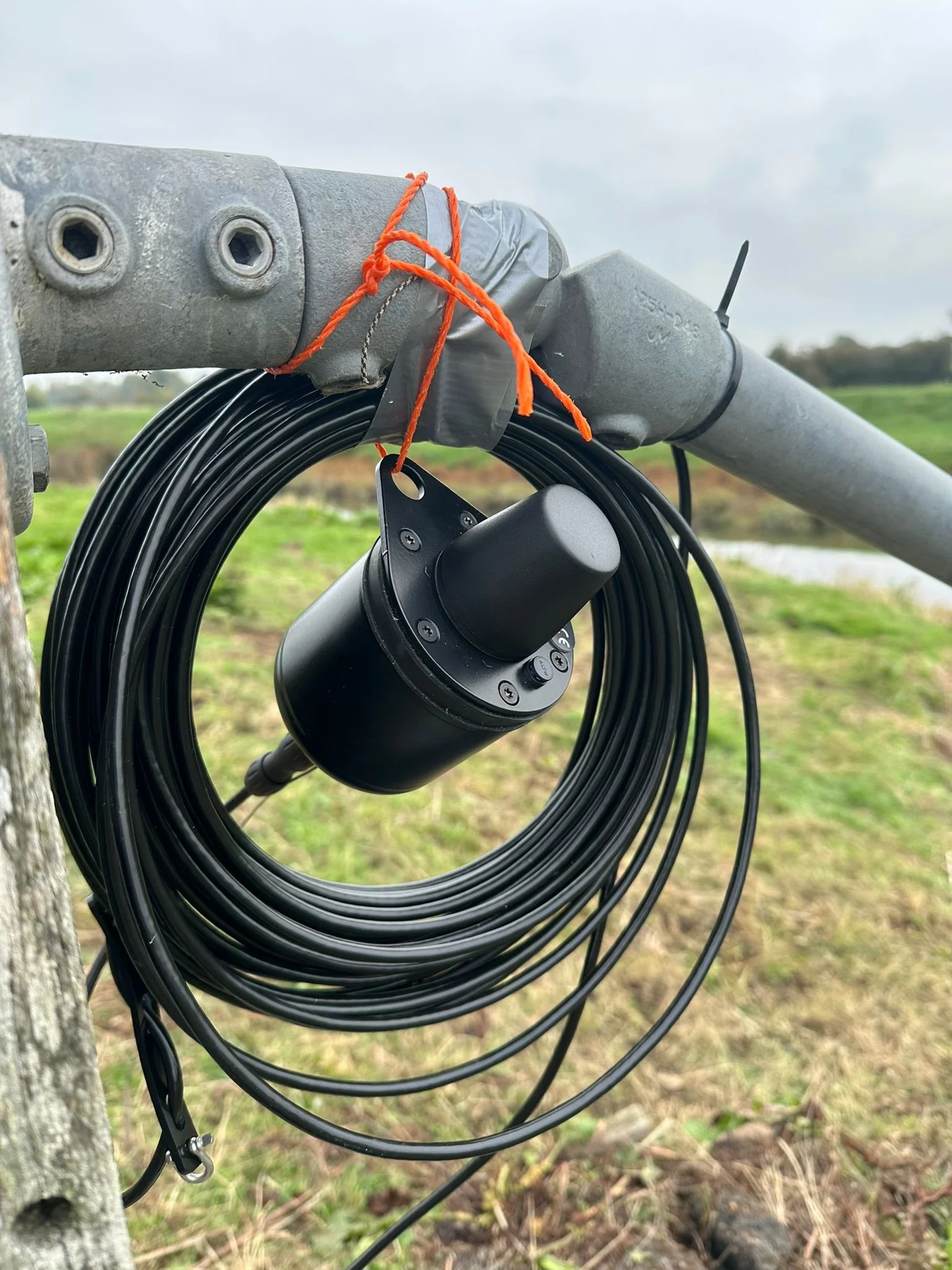
The technology: KISS logger + remote connectivity
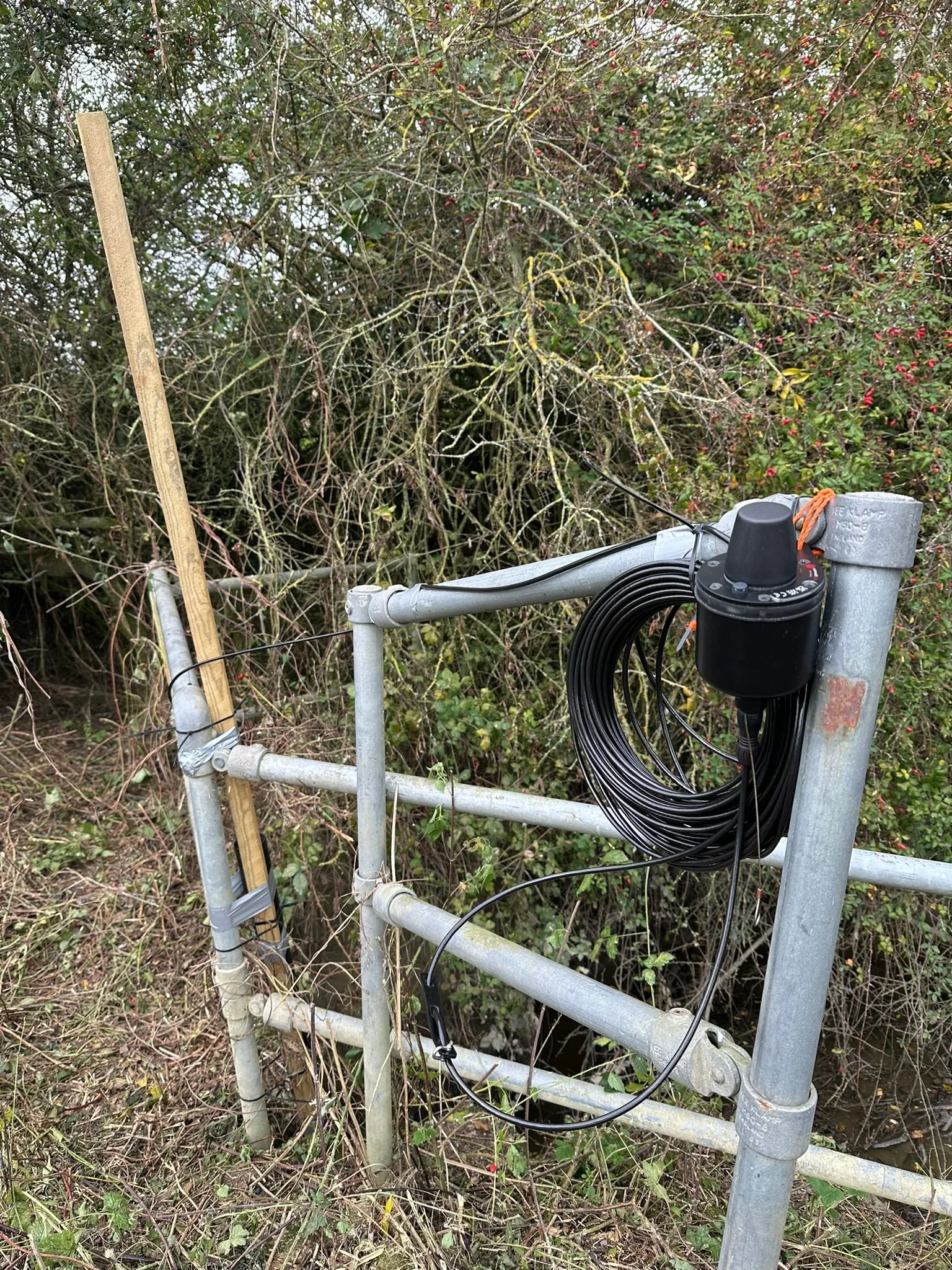
H2Ogeo is using KISS data logger systems (developed by Van Walt) installed to continuously record water levels (H2Ogeo). These loggers are compact, robust, and capable of transmitting data via LoRaWAN or cellular networks (H2Ogeo). Because of this, they can be placed in both rural and semi-urban settings, without heavy infrastructure for data retrieval (H2Ogeo).
This real-time, remote sensing setup gives a fully managed solution: deployment, commissioning, data visualisation, alerts and reporting.
On-site deployment: two KISS elevation monitors
At the Adur site, H2Ogeo has deployed two automated KISS elevation monitoring devices along the riverbank. These installations enable the team to monitor spatial and temporal variation in water levels at the site.
How the Green LEAP grant made it possible
H2Ogeo explicitly acknowledges that the expansion of their remote groundwater elevation monitoring capability was supported by funding from Horsham District Council Green LEAP (H2Ogeo).
Green LEAP is a local funding initiative (via Horsham District Council) for innovation, green infrastructure or environmental technology. Through that support, H2Ogeo has been able to absorb part of the cost of procuring, installing and commissioning the remote sensor network.
Because of the grant, H2Ogeo can offer a “turnkey” remote monitoring service (hardware, comms, analytics) to projects like OART’s Adur schemes, which strengthens the evidence base of nature-based interventions.
To find out more Contact Us today.
@horshamdc @enterprisinghorsham #UKSPF #GreenLEAP

@horshamdc @enterprisinghorsham #UKSPF #GreenLEAP
Sources:
Groundwater Elevation Monitoring - H2Ogeo — H2Ogeo
https://oart.org.uk/projects/adur-adaptation-project